Home > Blog > Weather
El Niño to end, La Niña to follow?

While El Niño is drawing closer to its end, it may still have an effect in several parts of the country this month. Dry condition may affect the province of Marinduque ,while dry spells are expected in Benguet, Ilocos Norte, Ilocos Sur, La Union, Batanes, Cagayan, Isabela, Nueva Vizcaya, Quirino, Aurora, Batangas, Laguna, Oriental Mindoro, Romblon, Albay, Camarines Sur, Sorsogon, Eastern Samar, Leyte, Northern Samar, Western Samar, Southern Leyte and Davao Oriental.
Meanwhile, droughts continue to threaten Abra, Ifugao, Kalinga Apayao, Mountain Province, Bataan, Bulacan, Nueva Ecija, Pampanga, Tarlac, Zambales, Occidental Mindoro, Palawan and Masbate.
In Visayas, droughts are likely to be experienced in Aklan, Antique, Capiz, Guimaras, Iloilo, Negros Occidental, Negros Oriental, Bohol, Cebu, Siquijor and Biliran. Affected areas in Mindanao include Zamboanga Sibugay, Camiguin, Lanao del Norte, Misamis Occidental, Misamis Oriental, Davao del Sur, South Cotabato, North Cotabato, Sarangani, Surigao del Norte, Sulu and Tawi-Tawi.
El Niño is now on its final stage, and is more likely to return to neutral condition by the end of July. While this may bring good news to our farmers highly affected by extreme drought, meteorological agencies warn the public about the impending occurrence of the La Niña.
The National Oceanic and Atmospheric Administration (NOAA) defines La Niña as a phenomenon characterized by the unusually low sea surface temperatures or cooling of the ocean in the Equatorial Pacific. NOAA added that a La Niña episode does not always follow an El Niño, but it may happen especially if the latter is a strong one.
The chief of PAGASA-Climate Monitoring and Prediction Section (CLIMPS), Mr. Anthony Lucero, said La Niña episode may occur on October to December 2016. As of now, there is a 50% chance that it will develop in the coming months.

According to PAGASA Weather Forecaster Buddy Javier, the La Niña’s effects in the Philippines may include the following:
1. Moderate to strong monsoon activity
The southwest monsoon or habagat is expected to affect the country during the rainy season, which usually sets in by the end of May to early June. If La Niña occurs, the activity of habagat may intensify, bringing more rains in the country.
2. Moderate to strong tropical cyclone activity
La Niña may also influence the intensity and impacts of tropical cyclones or bagyo that will enter the Philippine Area of Responsibility (PAR) in the second half of 2016.
3. Above-normal rainfall / wetter weather condition
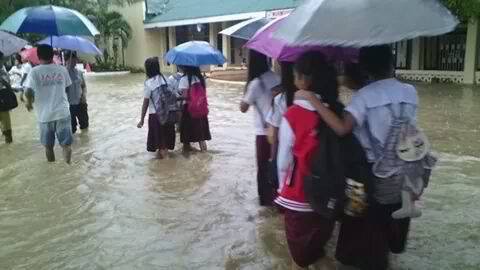
The opposite of El Niño, La Niña means more rains. More rains may trigger more flooding and landslides. After months of extremely dry days, we must now prepare for extremely wet days.
4. Near to below-normal air temperatures
By the time La Niña fully develops, the tag-init season may have already ended. Temperatures may return to normal or may be below average.
PAGASA will continuously monitor the weather while advisories will be immediately issued if needed. The public is advised to monitor updates.


