Home > Blog > Weather Today
Weather Today – September 27, 2018 #PAENGPH
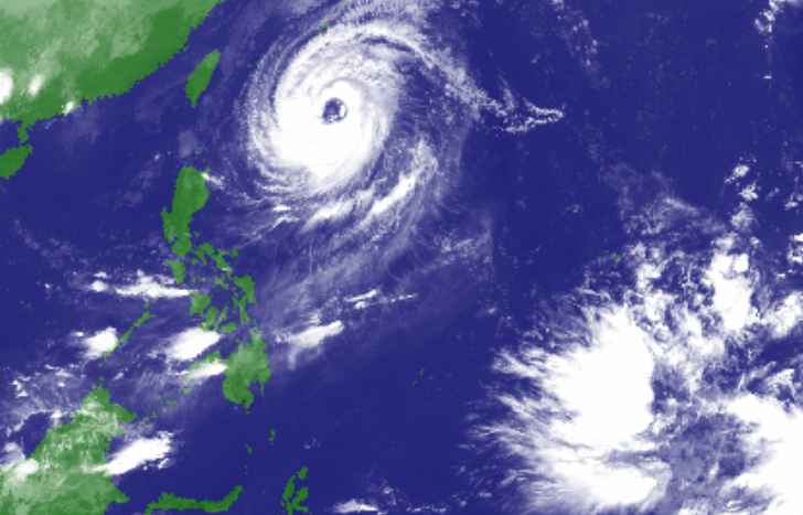
With its northward movement, Typhoon Paeng is forecast to leave the Philippine Area of Responsibility (PAR) on Saturday without any landfall activity.
Enhanced by the Typhoon, the Southwest Monsoon will bring cloudy skies with scattered rain showers in Zamboanga Peninsula, Northern Mindanao and Caraga. Elsewhere, partly cloudy to cloudy skies prevail and localized thunderstorms are possible. PAGASA raised a gale warning off the northern seaboards of Northern Luzon and the eastern seaboards of Luzon and Visayas. Fisherfolk and those with small seacraft are advised not to venture out, while larger vessels are advised to take precautionary measures against rough to very rough sea conditions.
Meanwhile, a new weather disturbance may threaten the country next week. According to PAGASA Weather Forecaster Ariel Rojas, a Low Pressure Area (LPA) was spotted at 3,100 kilometers east-southeast of Mindanao, outside PAR. It is forecast to intensify into a tropical cyclone and enter PAR next week.
Latest Advisories
