Home > Blog > Weather Today
Weather Today – October 16, 2015 | #LANDOPH; Metro Manila under Signal no. 1
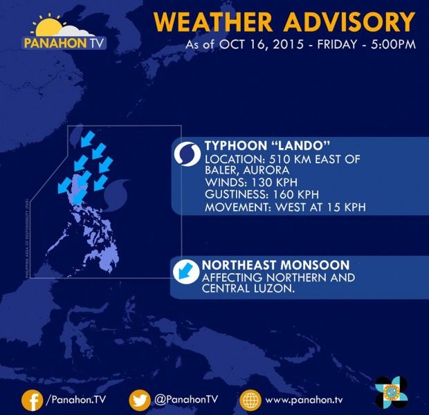

Typhoon Lando continuously gains strength in the East Philippine Sea with maximum sustained winds of 150 kilometers per hour and gustiness of up to 160 kilometers per hour. With its westward movement at 15 kilometers per hour, PAGASA Weather Forecaster Aldczar Aurelio says it may hit Isabela tomorrow evening or Sunday morning. Lando is expected to bring heavy to intense rainfall within the 550-kilometer diameter of the typhoon, which includes Northern and Central Luzon.
PAGASA raised Public Storm Warning Signal Numbers 1 and 2 over several areas in Luzon. The weather bureau monitors the movement of Lando towards the landmass of the Isabela-Aurora areas, which was alerted against rains with gusty winds in the next few hours.

Aurelio added that the slow movement of Lando is caused by the Fujiwhara effect of Tropical Storm Champi, which was last located outside the Philippine Area of Responsibility. Though Champi will not enter our boundary, as it moves northwards, it pulls Lando southwards. This causes Lando to stay longer in our boundary, possibly until Thursday.
Aurelio also said that this Sunday or Monday, a Ridge of High Pressure Area may block Lando from the West Philippine Sea, and may cause it to recurve northward.
Gale warning is still raised over the northern seaboard of Northern Luzon, and the eastern seaboards of Visayas. Venturing into these rough to very rough sea conditions might be dangerous for fishing boats and other small seacraft.

Latest Advisories
