Home > Blog > Weather Today
Weather Today – September 4, 2015 | LPA being monitored; ITCZ prevails

Still outside the Philippine Area of Responsibility (PAR), the low pressure area (LPA) was spotted at approximately 2,380 kilometers east of Visayas. According to PAGASA Weather Forecaster Jun Galang, the said weather disturbance could possibly enter our boundary by next week, probably on Tuesday and Wednesday. Galang added that its possibility to develop into a tropical cyclone remains slim as of now. However, changes may still occur.
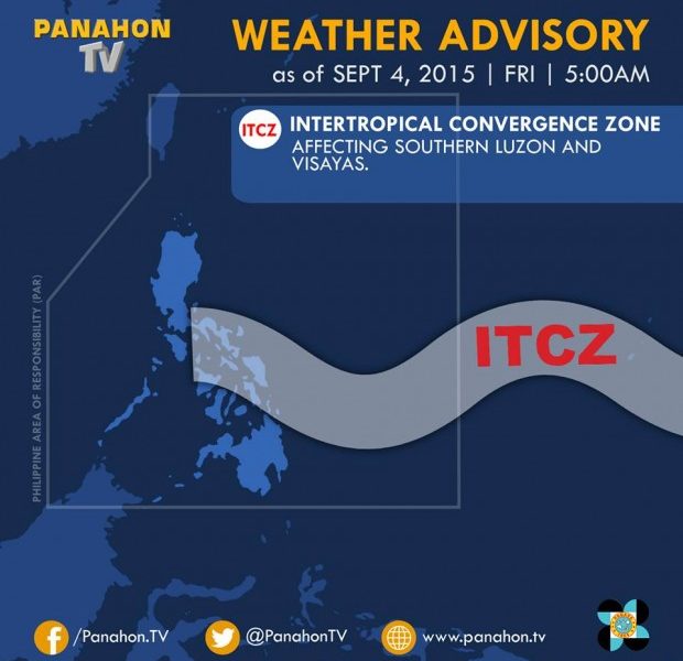
On the first Friday of September, the Intertropical Convergence Zone (ITCZ) continues to affect Southern Luzon and Visayas. Bicol Region, Eastern Visayas and the provinces of Quezon, Mindoro, Marinduque, Romblon and Batangas will experience cloudy skies with light to moderate rains and isolated thunderstorms. The rest of the country including Metro Manila will have partly cloudy to cloudy skies with isolated thunderstorms.
For this month, here is a forecast of temperatures in the key cities of the Philippines:

PAGASA advises the public that the average number of tropical cyclones which may enter the PAR this month ranges from 2 to 4. Due to the prevailing El Niño, Galang says strong cyclones may form in the Pacific as they may generate energy from the heat and amount of moisture in the ocean. However, experts say that before these cyclones move closer to our country, some may re-curve northward, moving away from the landmass.
El Niño occurs when there is a rising sea surface temperature (SST) and unusual warming of the ocean. Based on the latest information from different weather and climate agencies throughout the globe, El Niño may intensify and continue in the coming months or might last until May of 2016.

Latest Advisories
