Home > Blog > Weather Today
Weather Today – December 1, 2014 | Cyclone threatens the PH this week
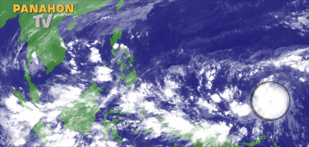
As the low pressure area (LPA) in the west of the country dissipated yesterday, a new LPA is spotted approximately 2,000 kilometers from the eastern boundary of the Philippine Area of Responsibility (PAR).
State weather forecaster Chris Perez says it has a possibility of intensifying into a tropical cyclone within 24 to 48 hours. Forecasting models show the weather disturbance entering PAR by Friday.
Perez adds that there are two likely scenarios that depend on the high pressure area northeast of the Philippines–the first is the LPA entering our area of responsibility and recurving to the northeast, and the second is the cyclone making landfall across Central Philippines.
PAGASA is closely monitoring the said weather disturbance as it is expected to be strong due to its proximity to the country. It could also intensify, gaining strength over the Pacific ocean.
It is noted though, that the location of the current weather disturbance is also where Super Typhoon Yolanda was formed last year. In case it intensifies into a cyclone and enters PAR, it will be named Bagyong Ruby, the first cyclone this month.
According to PAGASA’s climatological records, an average of one to two cyclones enter the PAR during December, with a high probability of landfalling in Visayas and Mindanao.

Meanwhile, Perez said the easterlies will remain the dominant weather system today, bring partly cloudy to cloudy skies. Possible thunderstorms and isolated rain showers are expected, mostly over the eastern section of the country.
Also, a gale warning is issued over the northern seaboards of Northern Luzon. Expect rough to very rough sea conditions and strong to gale force winds due to the surge of the northeast monsoon.

Latest Advisories
