Home > Blog > Weather Today
Weather Today – August 8, 2014 | Typhoon Jose moves farther ; improving weather awaits PH
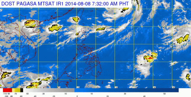
After Typhoon Jose left the PAR (Philippine Area of Responsibility) yesterday, it continues to enhance the Southwest Monsoon or habagat. However, compared to the past few days, it only affects Northern Luzon, bringing improved weather to most parts of the country.
According to the latest data from PAGASA (Philippine Atmospheric Geophysical and Astronomical Services Administration), Typhoon Jose was estimated at 1,000 kilometers northeast of Itbayat, Batanes. As it continues to move away from the country, it is now heading towards the southern part of Japan.
Ilocos Region, along with Batanes and the Calayan Group of Islands, will experience occasional rains. Residents of Metro Manila and the rest of the country will have partly cloudy to cloudy skies with chances of isolated rainshowers or thunderstorms.
Meanwhile, a gale warning is still up for the seaboards of Northern and Central Luzon due to the surge of habagat. Fishing boats and other small seacraft are advised not to venture out into the mentioned seaboards as rough to very rough sea conditions may cause risky travel.
Gradual Weather Improvement over the Weekend
Almost the entire archipelago can expect a generally fair weather this weekend. PAGASA’s 3-day weather forecast shows that we can look forward to partly cloudy to cloudy skies with isolated rainshowers or thunderstorms. There were cloud clusters spotted outside PAR but according to PAGASA Weather Forecaster Alvin Pura, they are no cause for concern. “There are cloud clusters but are too far to affect the country. As of now, none of these are expected to enter the area of responsibility within the next three days.”

Latest Advisories
