Home > Blog > Weather Today
Weather Today – October 29, 2018 #ROSITAPH

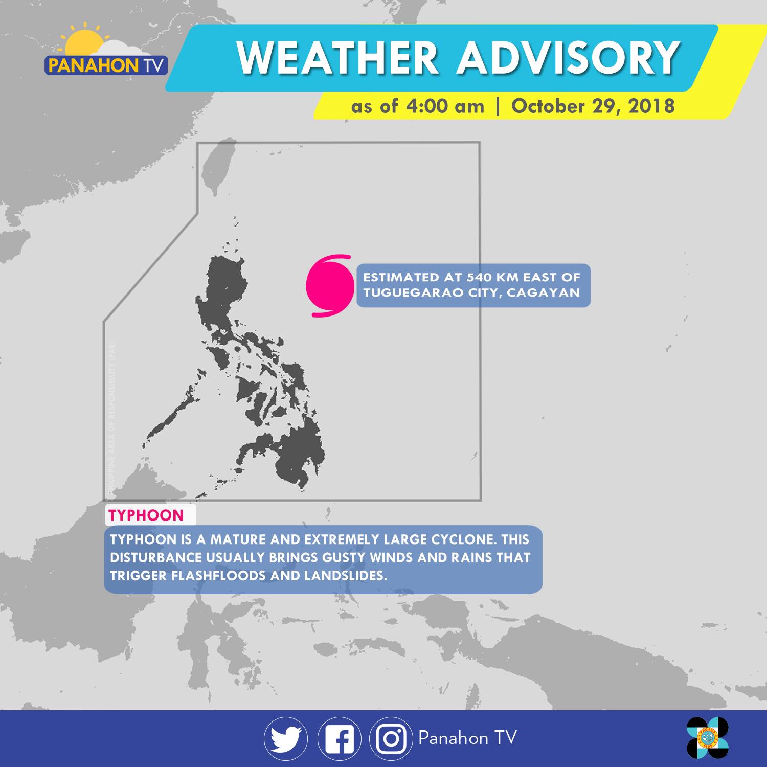
As of 5:00 a.m., Typhoon Rosita was spotted 540 kilometers (km) east of Tuguegarao City, Cagayan. It has maximum sustained winds of 170 kilometers per hour (kph) and gustiness of up to 210 kph. The Typhoon has slightly weakened as it moves westward at 15 kph. It will bring stormy weather or heavy rains with strong winds in Cagayan, Isabela, Quirino, Aurora and Polilio Island. Meanwhile, rains with gusty winds are expected in the Cordillera Administrative Region, Ilocos Region, the rest of Cagayan Valley and Central Luzon, and the provinces of Rizal and Camarines Norte. Due to its trough or extension, Metro Manila, the rest of CALABARZON and of Bicol Region will have cloudy skies with scattered rain showers and thunderstorms. Meanwhile, partly cloudy to cloudy skies with isolated rain showers will prevail in the rest of the country.
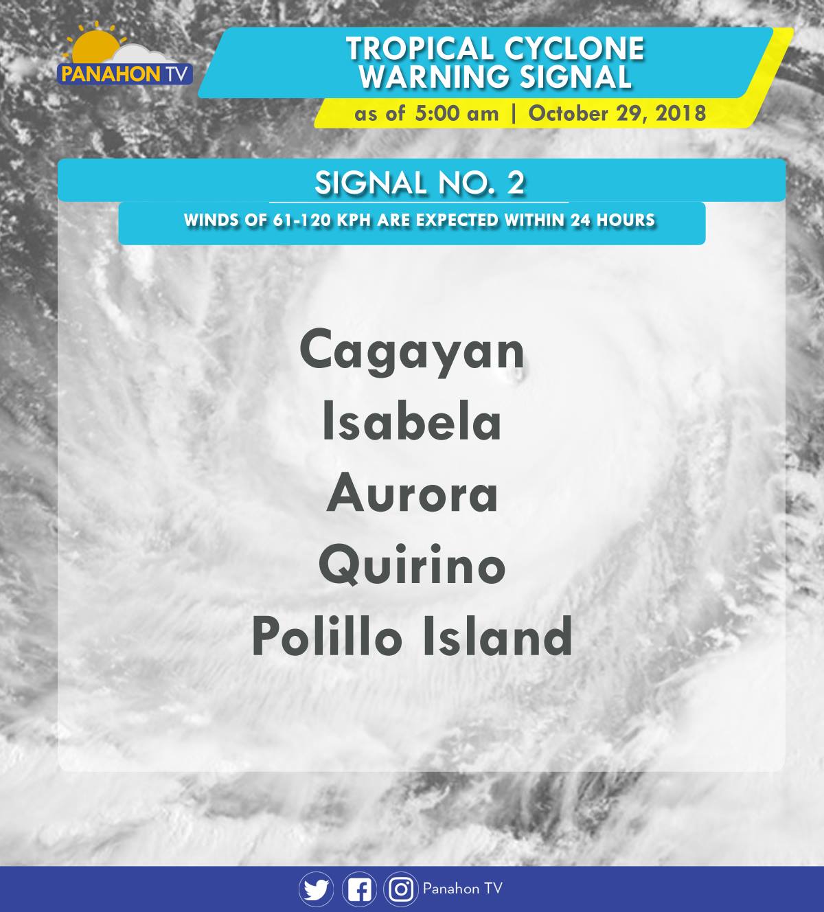
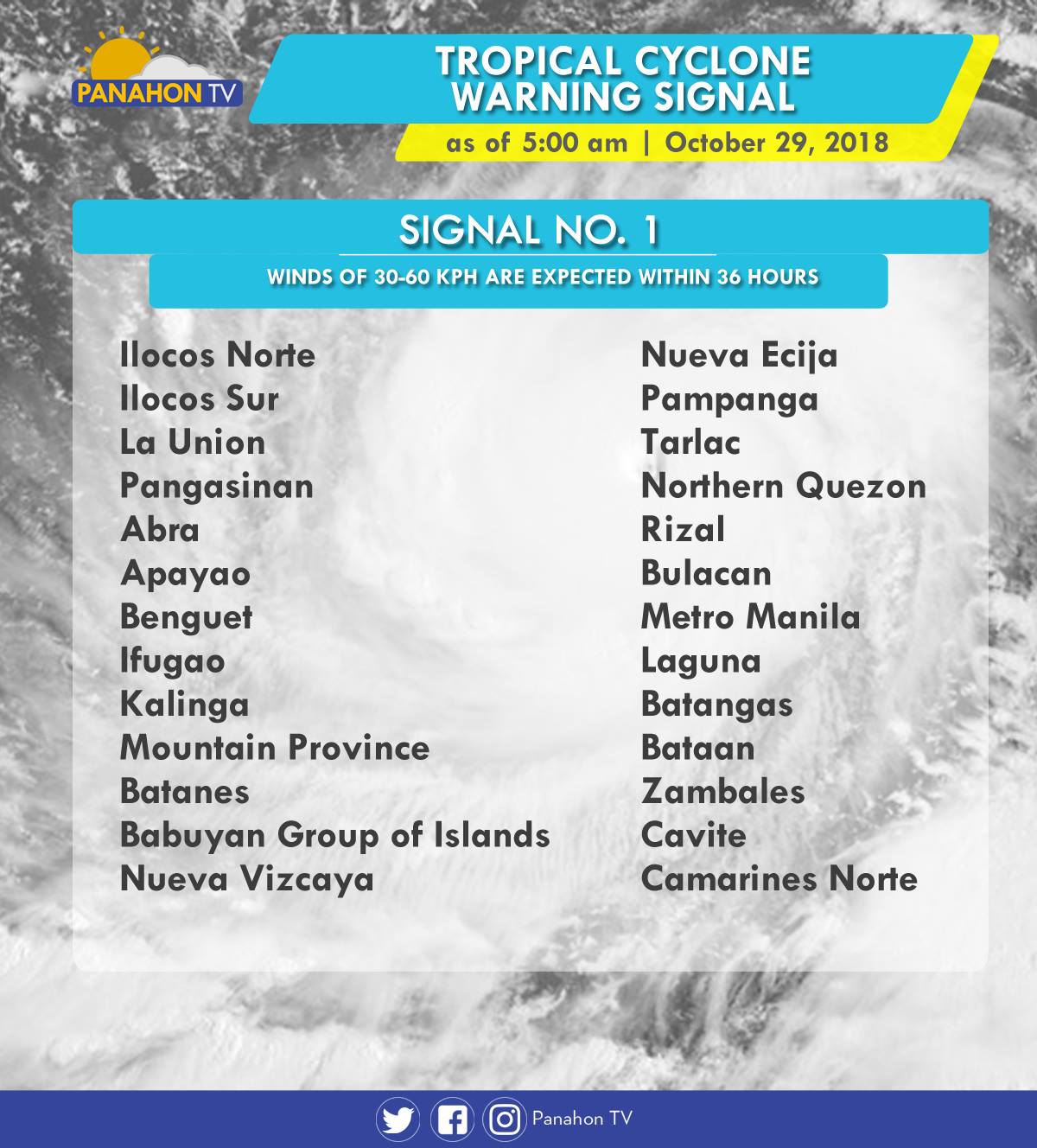
As Typhoon Rosita approaches the eastern section of Northern Luzon, Tropical Cyclone Warning Signals (TCWS) are raised by PAGASA in the following areas in preparation for incoming Typhoon.
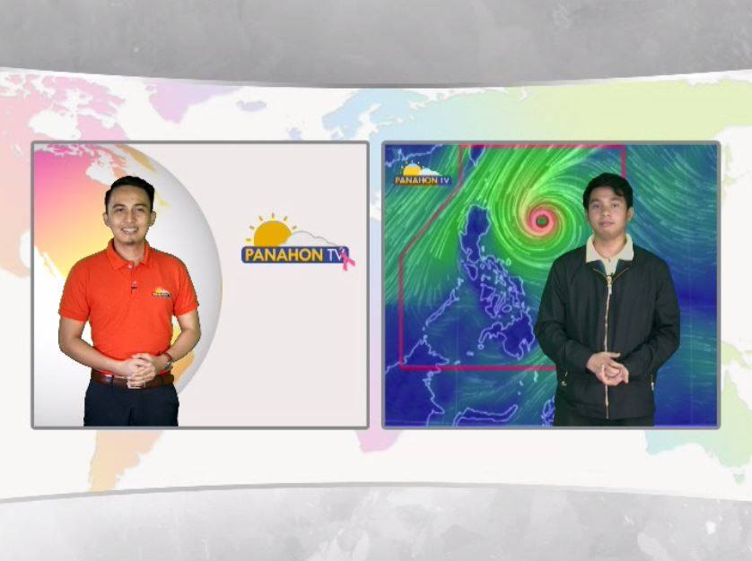
In an Interview with PAGASA Weather Forecaster Ezra Bulquerin, he mentioned that the Typhoon may slightly weaken as it traverses the landmass of Northern Luzon. Although some parts of the country are already experiencing stormy weather, the Typhoon is expected to hit the landmass of Isabela-Cagayan later this evening. He also added that the Northeast Monsoon will not strengthen the Typhoon, but will only steer it toward Northern Luzon.
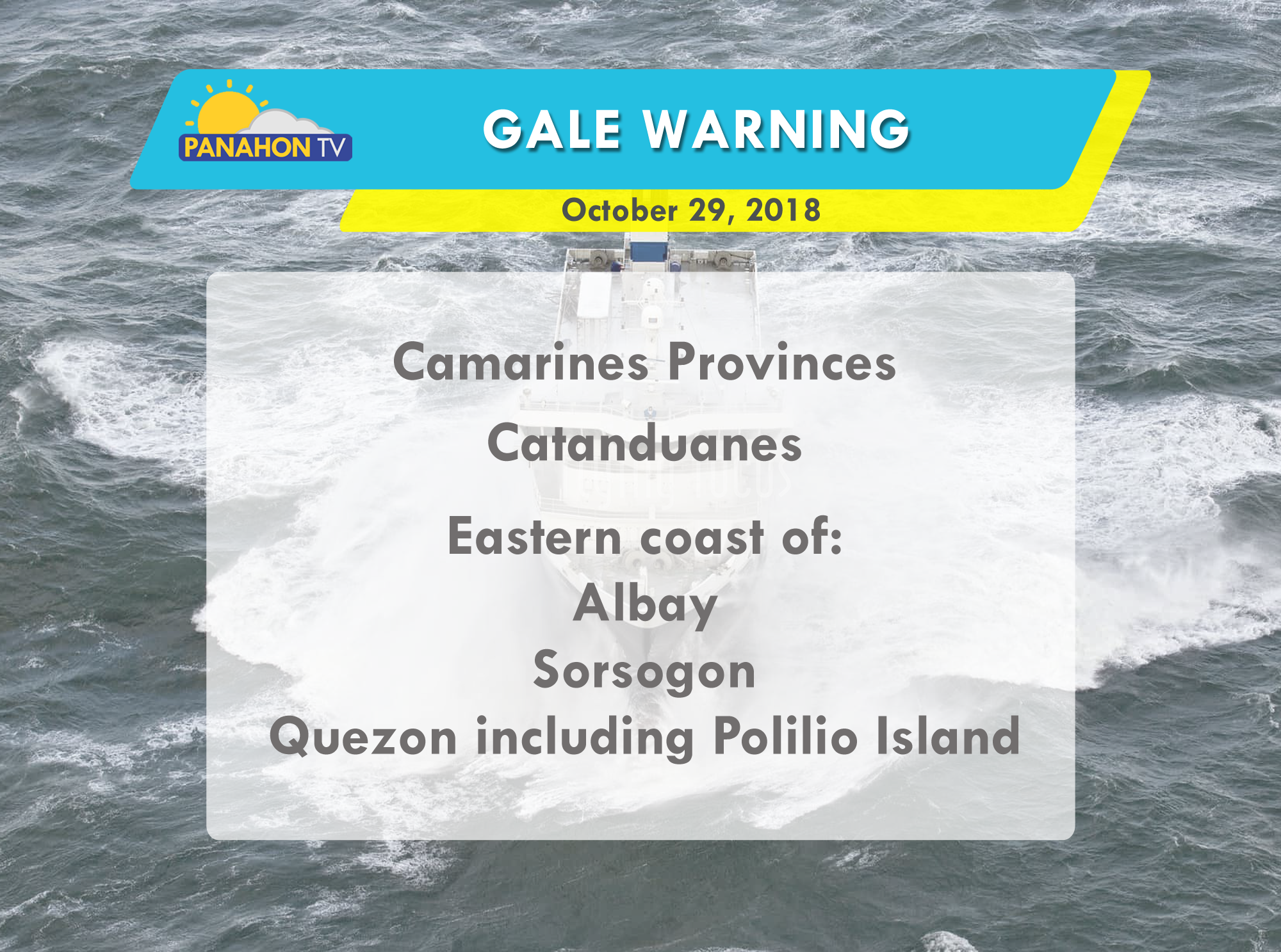
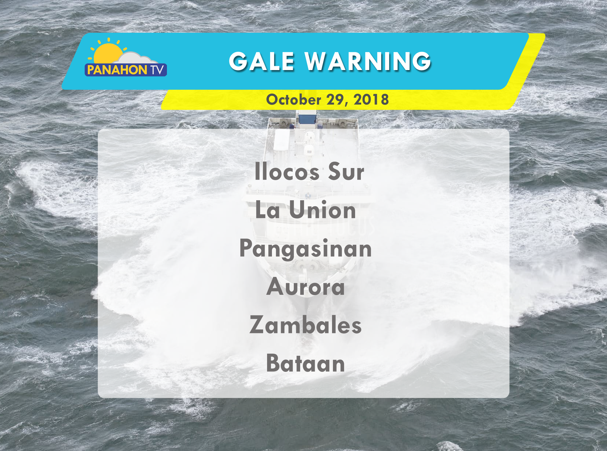
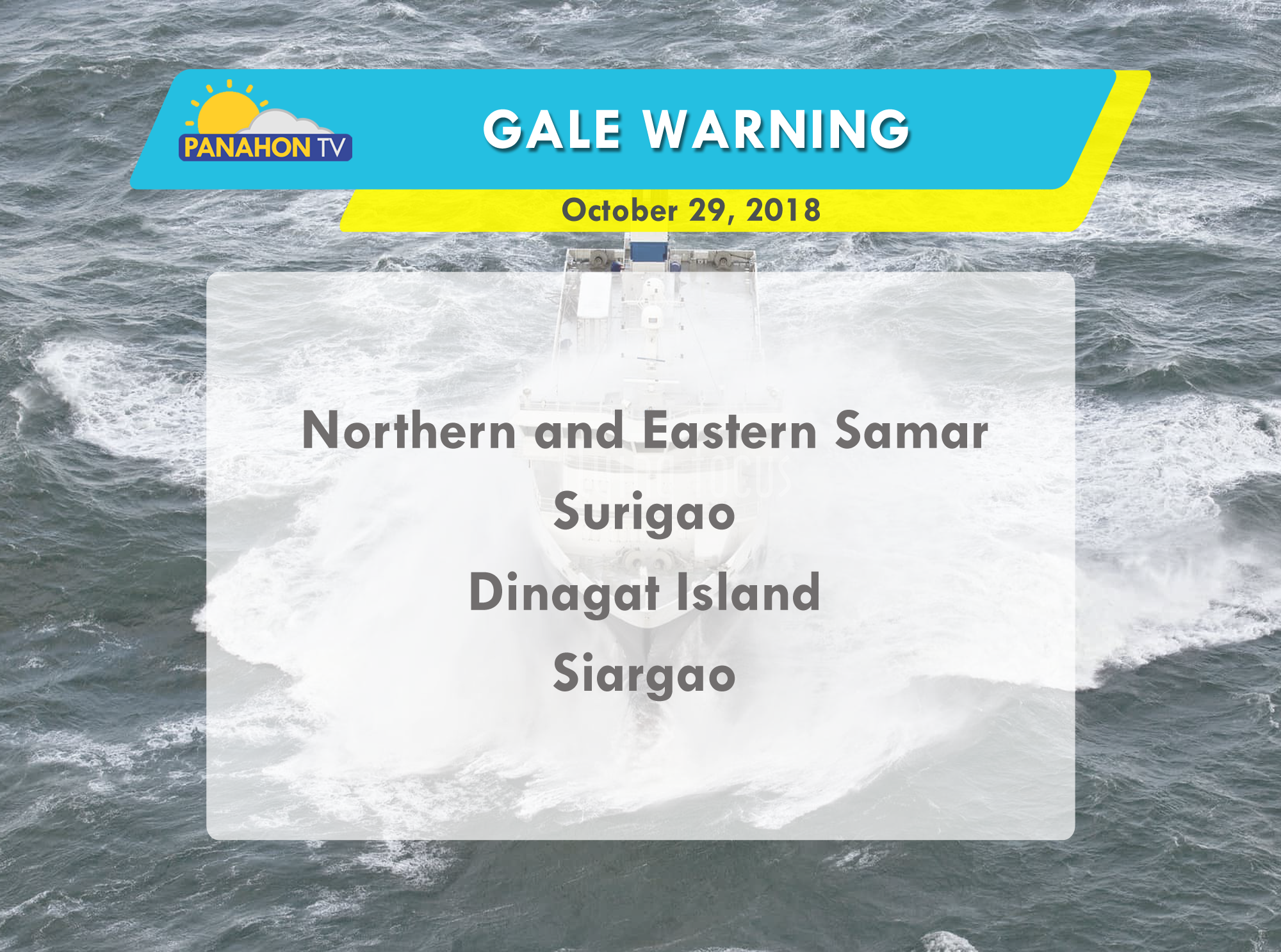
Due to strong waves brought by the Typhoon, gale warning is issued in the following areas:

Patrick
Patrick Obsuna is an Astronomy graduate from Rizal Technological University. He did his internship in Panahon TV as a student correspondent reporting on Astronomy related segments and was later on hired as a reporter. He likes to promote Astronomy as a course to be studied and learned. He enjoys playing the violin in his free time.
Latest Advisories
