Home > Blog > Weather Today
Weather Today – September 13, 2018 #OMPONGPH
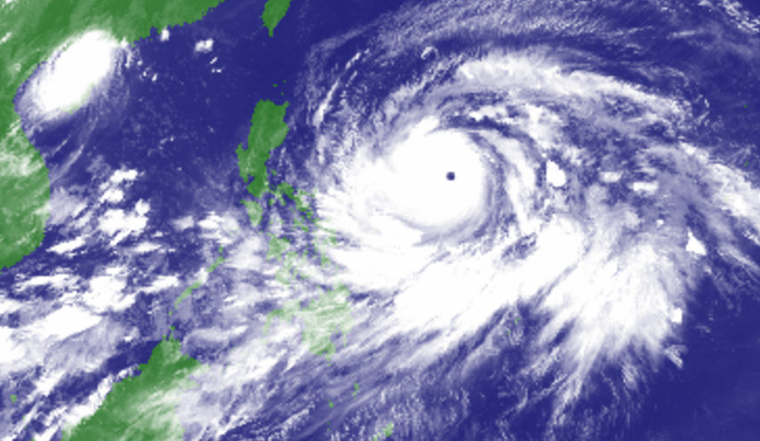
(updated as of 7:00 a.m.) Almost 20 areas are under Tropical Cyclone Warning Signal as Typhoon Ompong persists.
Occasional rains and gusty winds will be experienced over the areas under signal number 1. Winds of 30-60 kph may be expected in at least 36 hours or intermittent rains may be expected within 36 hours. PAGASA advises the public to clean up drainage system, harvest crops that can be yielded and monitor the latest Severe Weather Bulletin.
At 4:00 a.m., the eye of Typhoon Ompong was at 855 kilometers east of Virac, Catanduanes. It has maximum sustained winds of 205 kilometers per hour (kph) near the center, gustiness of up to 255 kph, moving westward at 30 kph.
Today, Bicol Region and Northern Samar will experience rains with gusty winds that can trigger flooding and landslides. In Mindanao, rest of Visayas, Cagayan Valley, Aurora, Quezon and Palawan should brace for cloudy skies with scattered rain showers and thunderstorms. In the remaining pats of Luzon, including Metro Manila, partly cloudy to cloudy skies prevail only with isolated rain showers or thunderstorms.
The typhoon continues to threaten Northern Luzon. According to PAGASA Weather Forecaster Chris Perez, the typhoon is forecast to hit the northern tip of Cagayan on Saturday morning (September 15).
Flooding, landslides and storm surge may also occur.
In the midst of typhoon monitoring, the public is reminded to stay vigilant to avoid misinformation.
Latest Advisories
