Home > Blog > Weather Today
Weather Today – December 19, 2017
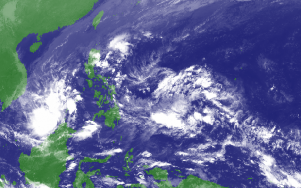
Tropical Depression “Urduja”, the 21st tropical cyclone this year, has exited the Philippine Area of Responsibility (PAR) and was last located at 430 kilometers (km) west of Puerto Princesa City, Palawan. It has maintained its strength with maximum winds of 45 kph and gustiness of up to 60 kph.
In Palawan, cloudy skies with scattered rain showers and thunderstorms will prevail due to the trough of the Tropical Depression. The same weather condition is expected in the provinces of Cagayan, Isabela and Aurora due to the Tail-end of a Cold Front.
Meanwhile, the Northeast Monsoon or Hanging Amihan remains dominant, bringing cooler weather with scattered rains in Metro Manila, the Ilocos Region, the Cordillera Administrative Region and the rest of Cagayan Valley and Central Luzon. The rest of the archipelago will experience partly cloudy to cloudy skies with isolated rain showers or thunderstorms.
Gale warning is still in effect in the eastern, northern and western seaboards of Luzon. Rough to very rough sea conditions may be risky for travelers. Fishing boats and other small seacraft are advised not to venture out into the sea as wave height may reach 4.5 meters.
Meanwhile, the Low Pressure Area outside the PAR was last spotted at 1, 710 km east of Mindanao. In an interview with Panahon TV, PAGASA Weather Forecaster Gener Quitlong said this weather disturbance may enter the PAR tomorrow or on Thursday. PAGASA is not ruling out the possibility for the LPA to develop into a Tropical Cyclone, which may traverse Northern Mindanao or Eastern Visayas.

#UrdujaPH unleashes enormous rainfall
Urduja has dumped a vast amount of rain in Eastern Visayas on December 14 to 17, 2017. During the peak of heavy rains, PAGASA recorded the top three highest rainfall in the following areas:
Guiuan, Eastern Samar – 780 mm (December 14)
Catarman, Northern Samar – 347.4 mm (December 15)
Borongan, Eastern Samar – 343 mm (December 14)
The 24-hour amount of rain recorded in Guiuan was twice its normal monthly rainfall. Quitlong said the slow pace of the cyclone is a factor why rains were greatly concentrated in the Samar area. The ongoing weak La Niña may also be a contributing element. La Niña is characterized by unusually cooler than normal sea temperatures in the Central and Eastern Equatorial Pacific (CEEP), which can cause more rainfall in the Philippines.
Latest Advisories
