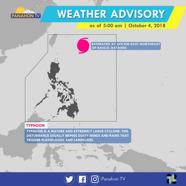
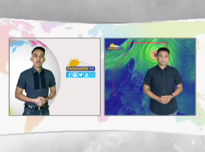
At 3:00 AM today, the eye of Typhoon #QueeniePH was last spotted at 670 km east-northeast of Basco, Batanes. It has maximum sustained winds of 150 kph and gustiness of up to 185 kph, moving northwest at 20 kph. The typhoon is expected to exit the Philippine Area of Responsibility tonight at around 9:00 p.m. to 10:00 p.m.
According to PAGASA Weather Forecaster Ariel Rojas, the heavy downpour last night and last Tuesday were not directly caused by the typhoon, but by localized thunderstorms. As the typhoon continues to move away from the country with no direct effect, its trough or extension still brings cloudy skies with scattered rain showers and thunderstorms in Central and Eastern Visayas, Northern Mindanao and CARAGA. In the remaining parts of the country including Metro Manila, partly cloudy to cloudy skies prevail with only isolated rain showers.

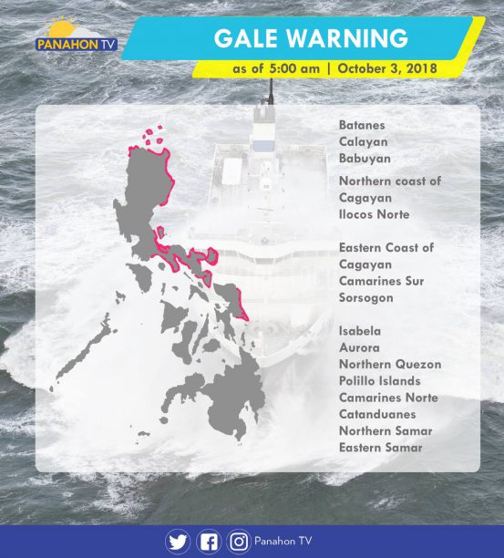
Meanwhile, gale warnings are hoisted in the northern and western seaboards of Northern Luzon, and the eastern seaboard of Luzon. Fishing boats and other small seacraft are advised not to venture out into the sea, while larger sea vessels are alerted against big waves.
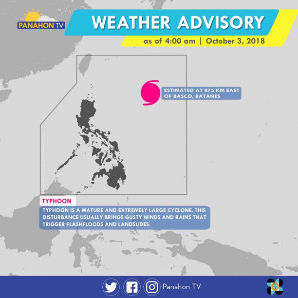
At 3:00 a.m. today, Typhoon #QueeniePH was spotted 875 kilometers east of Basco, Batanes. Moving northwest at 20 kilometers per hour (kph), it has maximum sustained winds of 200 kph and gustiness of up to 245 kph. Due to the trough of Typhoon Queenie, cloudy skies with scattered rain showers and thunderstorms are expected in Central Luzon, Eastern Visayas, Northern Mindanao, and Caraga. Meanwhile, partly cloudy to cloudy skies with isolated rain showers will prevail in Metro Manila and the rest of the country.
According to PAGASA Weather Forecaster Chris Perez, although Typhoon Queenie is not expected to make its landfall, it will still bring rains in due to its trough. If its speed remains constant, it is expected to exit the Philippine Area of Responsibility by Friday.
Meanwhile, gale warning is still issued in the following areas.